
A New Era of Hunting Maps
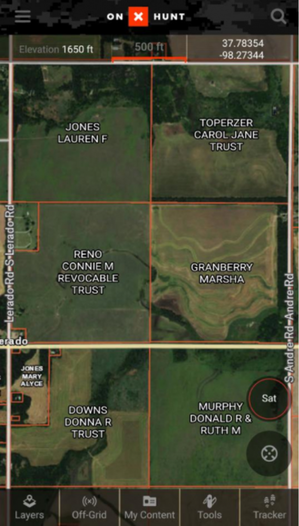
OnX Hunt already had a good product on its hands with its Hunt app, which included property boundary markings, landowner information and features to highlight public hunting properties.
The newest version of the onX Hunt software though, released July 31, adds more features for the hunter, angler and outdoorsman or woman. It’s a one-stop application across several platforms for all types of users.
I tested it recently to map a route on the Savannah River, using the line drawing feature to calculate distance from the boat ramp to points I wanted to check for potential fishing spots. Despite some boat motor trouble I ran into, I was still able to mark waypoints along the route at creek mouths and river bends I wanted to check when (and if) the motor ever decides to cooperate. After cussing and throwing things at the motor, onX Hunt’s nautical charts within the app allowed me to check water depths from home, giving me an idea where the deep holes holding catfish may be.
I’ll use these features even more in the fall and spring while scouting for sign, locating trails and marking stand locations. On unfamiliar public land, the property line and land ownership feature is invaluable. You can also search for landowner names throughout your state or nationwide.
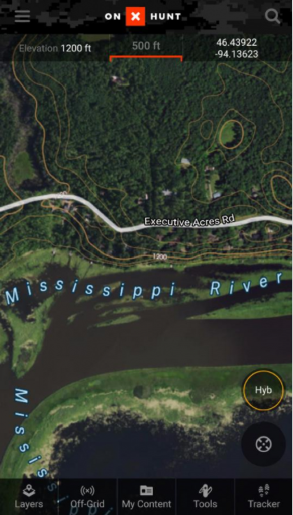
Before the cell phone signal goes out — and it always does — I’ll be able to save offline maps, beforehand, of hunting areas without needing cell service. With the new version, up to three basemaps save layers of things like landowner data, topography and satellite imagery.
If the smartphone screen gets too tight for scouting purposes, all of your data automatically synchronizes with the Web Map for personal computer use (www.onxmaps.com/web).
“This will let you scout at home,” onX product manager Matt Seidel said. “Any waypoints, tracks or lines you make will sync from your phone to computer and vice versa. And you can print unlimited paper maps.”
With your phone having a built-in GPS and able to save maps for offline use, the onX Hunt app replaces the need for a dedicated GPS unit. For those more comfortable with their GPS, onX still sells its popular GPS Hunt chip for a Garmin GPS on its website and through retailers nationwide.
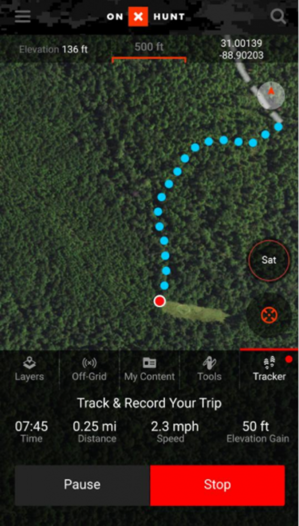
A new tracking feature maps your trek in the woods and several custom waypoint icons are available to mark everything from hunting stands to scat you found scouting.
Data usage costs for your phone are always an issue, but the time and gas money saved, especially if your hunting property is an hour or more away, makes it a wash with the ability to review detailed mapping at home. Plus, downloading and using offline maps saves you time and money.
Take the improved mapping program for a spin free for seven days. If you like what you see, sign up for a Premium membership for a single state-specific hunting map for $29.99 a year. If you’re going after a Grand Slam or traveling to hunt, the Elite nationwide membership costs $99.99 per year or $14.99 per month. Go to www.onxmaps.com/hunt for more info. NWTF members can use promo code "NWTF" for 20 percent off. A portion of every sale goes back to support NWTF. This is the new era of GPS hunting. Use every advantage you can get.